

Appleby History > History Tour > The Quick Tour
The Quick Tour
A frenetic gallop, chronologically undertaken
By Gerald Box
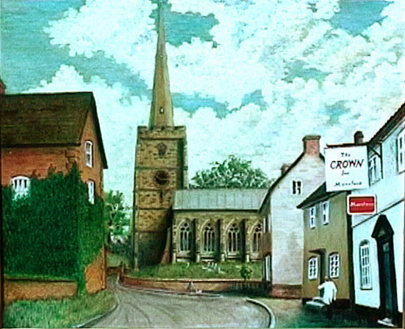 Church Street Church StreetA portrait by Clive Didcott (click on image to see larger version) |
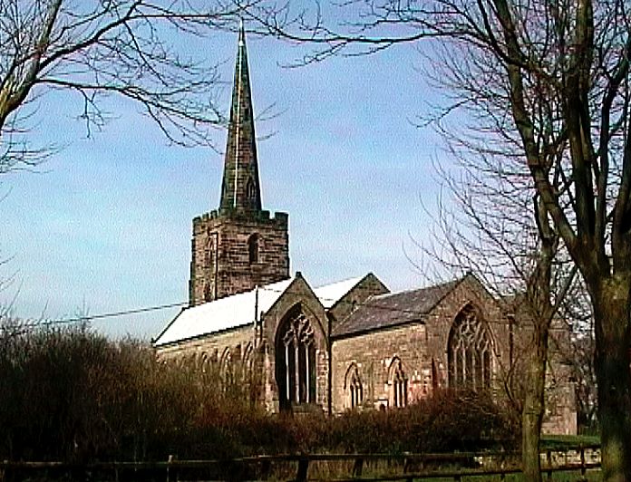 St. Michaels and All Angels St. Michaels and All AngelsDates from Circa. 13/15th century (Click on image to see larger version) |
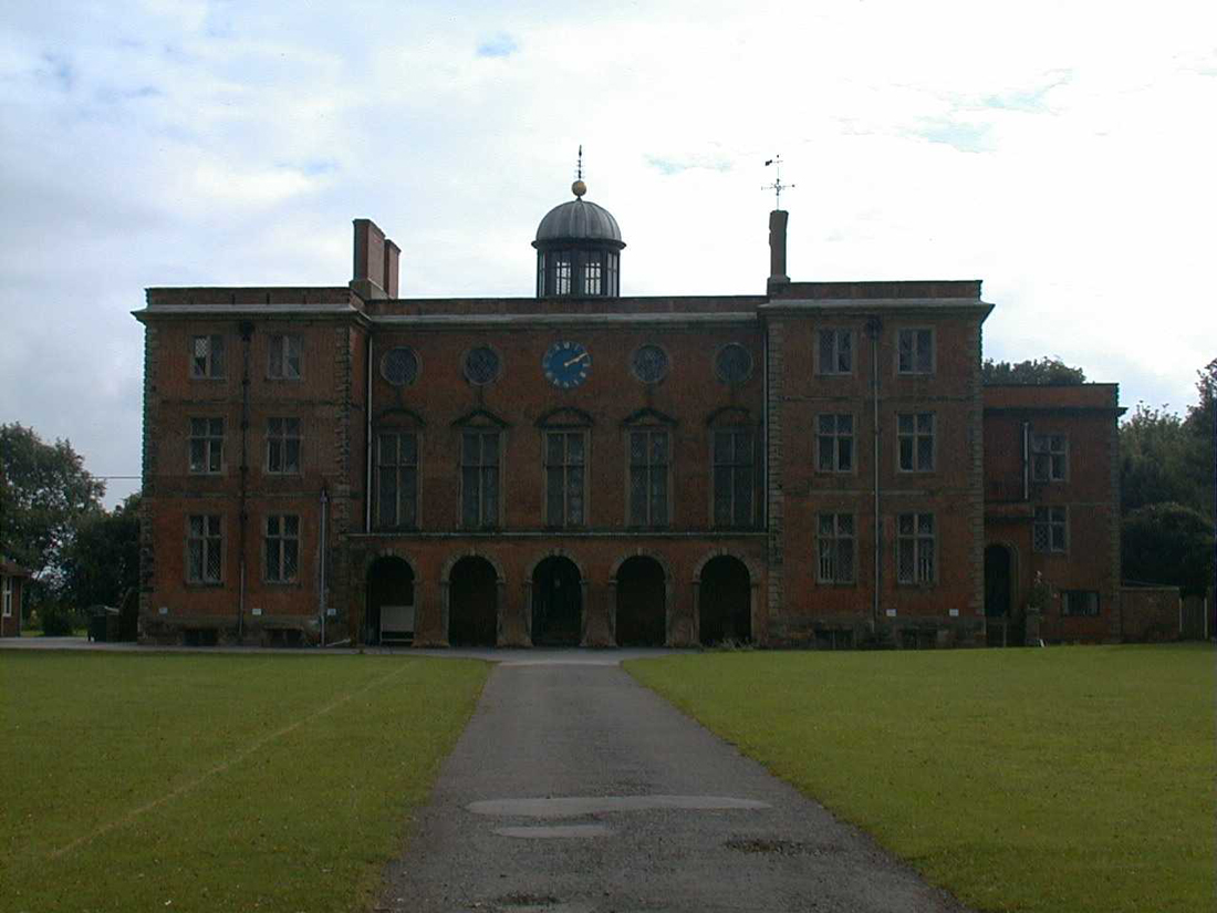 Sir John Moore School Sir John Moore SchoolEst. 1697 (Click on image to see larger version) |
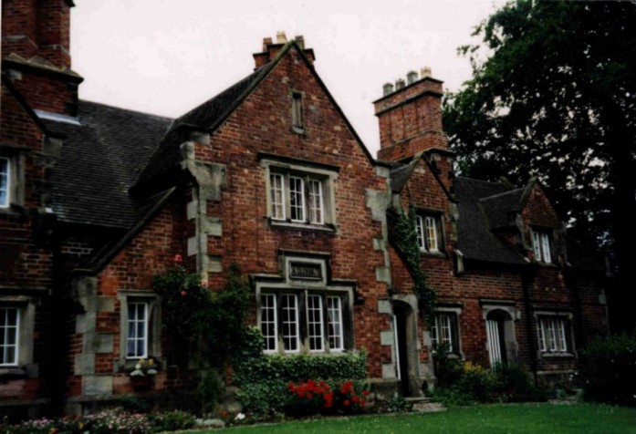 Misses Moore Almshouses Misses Moore AlmshousesEst. 1839 (Click on image to see larger version) |
 The Black Horse Inn The Black Horse InnEarly 17th century timber-framed (Click on image to see larger version) |
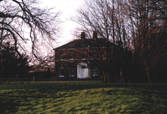 The Old Rectory The Old RectoryGeorgian House in its setting (Click on image to see larger version) |
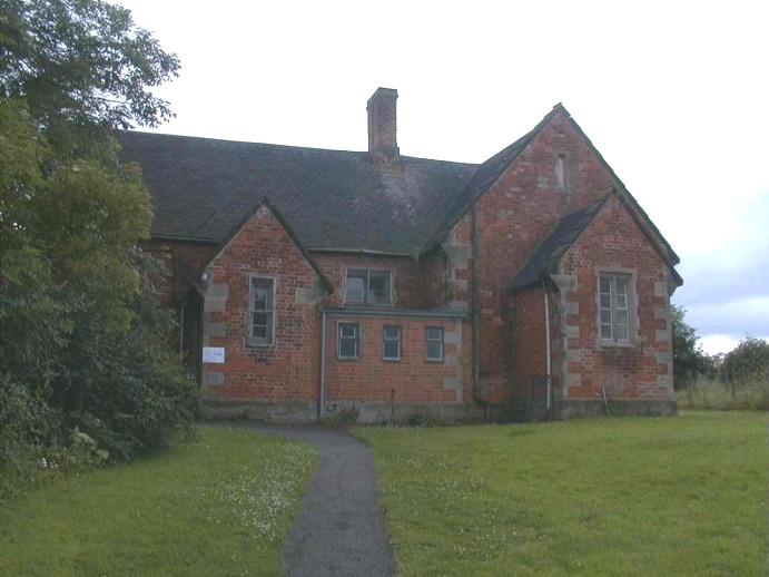 The Church Hall The Church HallOriginally built as a village school (Click on image to see larger version) |
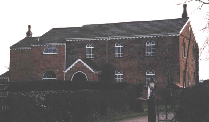 Former Baptist Chapel Former Baptist ChapelConverted to a house Est. 19th century (Click on image to see larger version) |
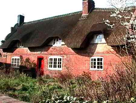 Thatched Cottage Thatched Cottage(Click on image to see larger version) |
A geographic feature is the most likely explanation for the founding of Appleby as a community. A small stream runs South to North and falls into the River Mease which forms the boundary, with the neighbouring parish of Measham. Near this point, [SK326108] on Sites and Monuments Recorded evidence has been produced of Iron Age settlement. [Professor St Joseph : Peek (1966) see Liddle P (ed) Archaeological Report No 4, 1982, page 12, publisher Leics. Museums, Art Galleries and Records Service] This suggests a date of settlement somewhere between 1,000 BC and the arrival of Romans. Evidence of their presence in Appleby includes the finding of a coin of possibly Roman origin in Appleby Parva [approx SK310087], and other remains recently excavated at the site of the new development in Rectory Lane. It is also established that a Roman road, the Via Devana passed approximately East-West through North Leicestershire.
Place name information offers greater present certainty of the presence of Anglo-Saxons and Vikings. The suffix "by " is accepted within philology as proof of Viking occupation. The conjunction very nearby of the counties of Leicestershire, Staffordshire, Derbyshire and Warwickshire also adds to the evidence that the site of Appleby was within "frontier territory" in the early to mid-medieval era [400-800 AD]
The Domesday Book lists Appleby, though placing it in Derbyshire. Parts of the village remained within that county until 1897. It was the Countess Godiva, widow of earl Leofric of Mercia, who in 1087 had her only landholding in Leicestershire, held on the king's behalf, within Appleby. Another landholder within Appleby was Robert (one of six so named in Domesday) with a smaller landholding.
It would be a prestigious claim for the village that a Saxon mill existed. But the only water mill recorded for the six communities within the then Derbyshire portion of what is modern Leicestershire, was at Stretton (en-le-field).
The church 13/15C. at Appleby is rightly quoted as one of its attractive features but this is true of thousands of English villages. The present state of knowledge of the village's development has not led to any suggestion of an earlier structure on the site but this does not preclude the existence of one. Many pre-Conquest settlements had wooden churches which were superseded by the successive waves of Norman church building in 13C and 15C.
The church stands within 150 metres of Appleby's Moat house another feature common to the English medieval landscape. Appleby's is one of 6,000 moated sites in England. It may pre-date the church and would have attracted development in its near vicinity especially given that its layout included the forming of a dam to provide a head of water for a watermill. This is thought to have been on the site of the present Post Office and stores. [Sites and Monuments Record: File No AA 32256/1] The juxtaposition of two high status buildings, Church and Moat House as early as the 13C, both near the stream, suggests that Appleby had by then formed its first centre.
Top Street Evidence from pottery fragments recovered from a 1997 watching brief [University of Leicester Archaeological Services ref. P49/666.1] carried out as part of a new housing scheme, however, suggests also 13 and 14 C occupation in this area. A map of Leicestershire by John Prior in 1777 is thought to be the first based on reliable cartography. [Leicestershire in 1777: ed. Welding JD : Leicestershire Libraries and Information service, 1984] This bears out that the village had formed in a rough square pattern round those roads now named Church St., Top street, Mawbys Lane and Black Horse Hill. The field patterns showing on the first 1/2500 scale Ordnance Survey sheet [1882 issue no. XXII. 15.] bears this out, rectangular fields with their shorter sides bordering on the stream.
Hearth Tax Returns A few are available for Appleby and shed limited light on ownership, properties and the relative wealth of villagers within both Magna and Parva.
Probate Inventories There are a number of these and offer interesting insights into mainly 18C life. Much more work is required (and for Hearth tax Returns also) to identify the relevant properties and thus to build up a historically accurate picture which might offer pointers to village development.
Enclosure Appleby's fields were enclosed by a Parliamentary Act of 1772 which also saw the laying out of a formal road system. Though the Enclosure Award is available [Leicestershire Record Office] giving details of all strips of land plus their owners, and their subsequent consolidation into larger fields, the associated map has not been located. This loss greatly hampers research.
The Census of 1841 This is a valuable research aid though it gives only street names and detective work will be required to establish categorically an exact village map.
The 1882 1/2500 Ordnance Survey Map This studied with the 1891 Census provides a firm basis for reliable yoking of households to places identifiable within the village as then delineated. But it needs lots of work.
Gerald Box, 1998